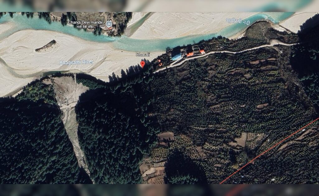
Dharali, a key halt en route to Gangotri, faces devastation amid cloudburst — affecting hotels, eateries, and homestays
Uttarakhand Flash Flood: Dharali Ravaged by Cloudburst, Google Earth Reveals Scale of Destruction
A sudden cloudburst in the Dharali region near Harsil triggered devastating flash floods and landslides on Tuesday afternoon, claiming at least four lives. Several others are feared trapped under debris, and widespread damage has been reported across the area.
The disaster struck around 1:45 PM, when heavy rainfall hit the Kheer Ganga river catchment, just 4 km from the Indian Army base in Harsil. Dharali — a vital stop on the Gangotri pilgrimage route — saw its hotels, restaurants, and homestays swept away by the force of the waters.
Villagers Flee as Floodwaters Surge
Eyewitnesses described panic as residents scrambled to higher ground. Shocking video footage captured muddy torrents rushing through the town, smashing through buildings and vehicles. Screams and cries for help echoed through the chaos.
According to an official Army statement:
“A massive mudslide hit Dharali, triggering a sudden surge of water and debris through the settlement.”
Army personnel were first on the scene, launching immediate rescue and relief operations.
Widespread Damage in Market Area
The nearby village of Kheer Gadh also witnessed a sudden rise in water levels, flooding markets and local homes. The State Disaster Response Force (SDRF), Police, Fire Department, and Army units are all involved in ongoing rescue efforts.
Authorities Issue Safety Advisory
The Uttarakhand Police issued a public warning, urging locals to stay away from riverbanks and safeguard children and livestock. Emergency helplines have been activated in affected areas.
Chief Minister Dhami Responds
Chief Minister Pushkar Singh Dhami called the situation “extremely distressing” in a post on X (formerly Twitter):
“Rescue teams from SDRF, NDRF, and the district administration are working on a war footing. I am monitoring the situation closely and praying for everyone’s safety.”
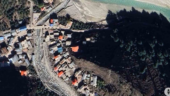
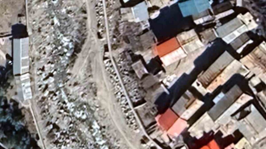
Google Earth Captures the Aftermath
Satellite images from Google Earth now reveal the full scale of destruction. Roads have vanished, buildings have collapsed, and mudflows continue to disrupt access to the region.
A Pattern Worsened by Climate Change
Flash floods and landslides are common during India’s monsoon season, but experts warn that climate change and unchecked construction in the fragile Himalayan zone are making such events more frequent and more severe.
Also Read : Uttarakhand Cloudburst Tragedy: 4 Dead, 50 Missing as Flash Floods Devastate Dharali Village